FREE SHIPPING Over $30 -> Up to 50% Off!
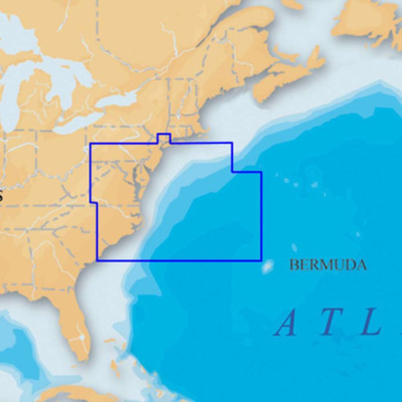
The Navionics Platinum+ U.S. Mid Atlantic & Canyons CF Card covers New Jersey, Delaware Bay, Chesapeake Bay, North Carolina, Bermuda, New York Harbor to Cape Romain, including Philadelphia, Norfolk and bathymetric details of all Mid-Atlantic Canyons. Multi
The Navionics Platinum+ U.S. Mid Atlantic & Canyons CF Card covers New Jersey, Delaware Bay, Chesapeake Bay, North Carolina, Bermuda, New York Harbor to Cape Romain, including Philadelphia, Norfolk and bathymetric details of all Mid-Atlantic Canyons. Multi-dimensional marine charts include comprehensive Nautical Chart, incredible fishing detail with SonarChart 1 ft HD bathymetry map, and Community Edits. Additionally, exclusive Platinum features take the boating experience to a whole new level: 3D view, high-resolution photo/chart overlay, port photos, and geo-referenced coast pilots. Register online for one year of daily updates to Nautical Chart, SonarChart and Community Edits.
Copyright © 2025 .All Rights Reserved.Powered by www.boatmaintenances.com
Reviews
There are no reviews yet.