FREE SHIPPING Over $30 -> Up to 50% Off!
Precision Contour HD Chart - South CarolinaPrecision Contour HD maps combine data from professional lake surveys, C-MAP Genesis Social Maps and traditional lake maps to deliver the most detailed statewide fishing maps.Meticulously surveyed to 1-foot increm
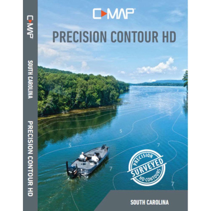
Precision Contour HD Chart – South Carolina
Precision Contour HD maps combine data from professional lake surveys, C-MAP Genesis Social Maps and traditional lake maps to deliver the most detailed statewide fishing maps.
Meticulously surveyed to 1-foot increments in shallow-draft boats by C-MAP’s survey crew with innovative Genesis technology, C-MAP Precision Contour HD maps include the shallow backwaters and distant creek arms uncharted by other map providers.
Featuring highly-detailed 1-foot contours, high-resolution satellite imagery and C-MAPs one-of a-kind Custom Depth Shading, Precision Contour HD maps offer comprehensive coverage that includes key fish-holding bottom structure like humps, holes, reefs, shoals, drains, ditches, ledges and breaklines.
The following lakes were mapped by C-MAPs fleet of hydrographic surveyors for the South Carolina chart card.
The following waterbodies included in the South Carolina chart card feature high-definition, 1- foot-contour maps. These charts are sourced from C-MAP Genesis Social Map, governmental agencies and other cartography providers.
Features:
This product may not be returned to the original point of purchase. Please contact the manufacturer directly with any issues or concerns.
 sale
sale
 sale
sale
Copyright © 2025 .All Rights Reserved.Powered by www.boatmaintenances.com
Reviews
There are no reviews yet.