FREE SHIPPING Over $30 -> Up to 50% Off!
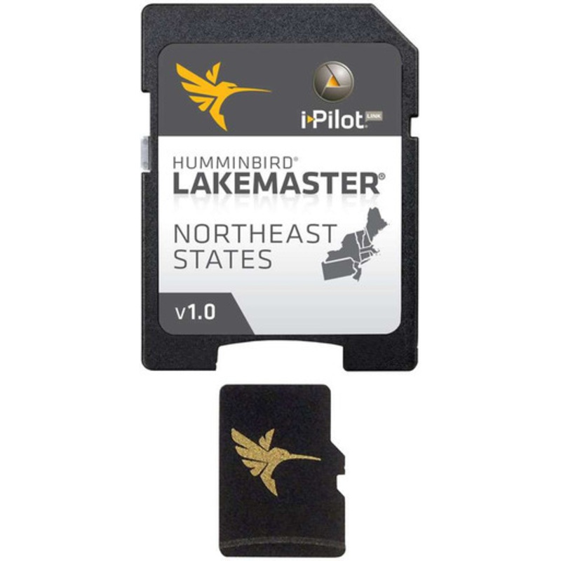
The Humminbird 600045-2 LakeMaster Chart - NorthEast States - MicroSD/SD is a part of Humminbird's series of LakeMaster Charts that give you a serious edge with their unmatched accuracy and detail. Patented features include the ability to select and highli
The Humminbird 600045-2 LakeMaster Chart – NorthEast States – MicroSD/SD is a part of Humminbird’s series of LakeMaster Charts that give you a serious edge with their unmatched accuracy and detail. Patented features include the ability to select and highlight a specific depth range, the option to shade shallow water ranging from 0 to 30 ft, and the power to synchronize depth chart contours and shorelines with the current water levels of rivers, lakes, and reservoirs. These exclusive features (and more,) will provide you with everything you need to make your time on the water more productive.
Covers Vermont, Rhode Island, Pennsylvania, New York, New Jersey, New Hampshire, Maine, Massachusetts, and Connecticut.
 sale
sale
 sale
sale
 sale
sale
Copyright © 2025 .All Rights Reserved.Powered by www.boatmaintenances.com
Reviews
There are no reviews yet.