FREE SHIPPING Over $30 -> Up to 50% Off!
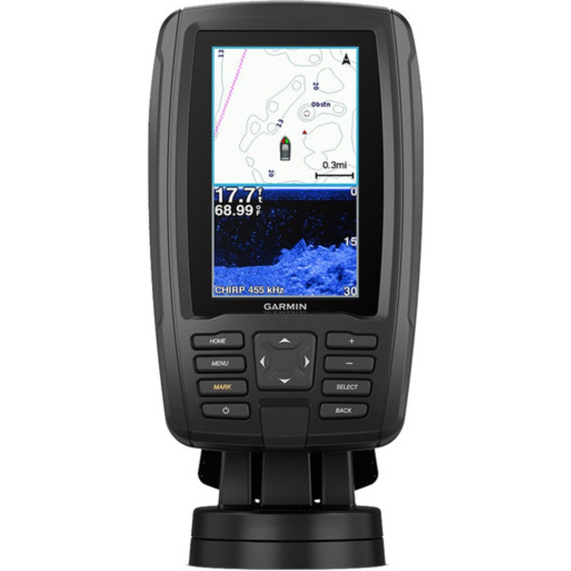
ECHOMAP Plus 44cv BlueChart G3 with GT20-TM TransducerA Great Addition to Any Fishing or Boating TripBright, sunlight-readable 4.3 comboIncludes GT20 transducer for Garmin CHIRP traditional sonar plus CHIRP ClearV scanning sonar with transom and trolling m
ECHOMAP Plus 44cv BlueChart G3 with GT20-TM Transducer
A Great Addition to Any Fishing or Boating Trip
This compact combo has lots of built-in benefits. Easy-to-install and even easier to use, it has a bright screen 4.3 display that is easy to read on a sunny day on the water. It includes a GT20 transducer for traditional Garmin CHIRP sonar that delivers remarkable target separation and CHIRP ClearV scanning sonar for nearly photographic images of whats below the boat. ECHOMAP Plus 44cv comes preloaded with BlueChart g3 charts with integrated Navionics data, covering the coastal U.S. Plus, it has Quickdraw Contours mapping software to instantly create personalized fishing maps on-screen with 1 contours as you fish. You own these maps. They are yours to keep private or share with theQuickdraw Community on Garmin Connect. Plus, you can share waypoints and routes with other ECHOMAP or STRIKER units. It also features a quick-release mount allowing you to quickly install and remove your device from power and mount.Transom and trolling motor mounts included.
The Garmin CHIRP Difference
The built-in sonar capabilities of ECHOMAP Plus 44cv include Garmin’s CHIRP traditional sonar, one of the most sophisticated sonar technologies available for the fishing and boating public. CHIRP traditional sonar provides amazingly clear target separation and definition, because it puts even more energy onto the target than traditional sonar. It also provides traditional sonar support for Minn Kota and MotorGuide trolling motors with integrated transducers.
Clear Scanning Sonar Images
Garmin CHIRP ClearV scanning sonar gives you a nearly photographic image of whats below your boat. You clearly see structure, submerged objects and fish. Garmin CHIRP traditional sonar and CHIRP ClearV scanning sonar are combined into 1 transducer.
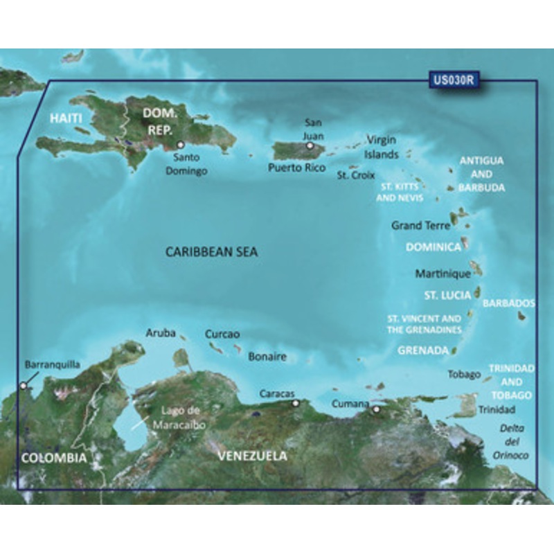
Preloaded BlueChart g3 Charts
This ECHOMAP Plus combo features preloaded BlueChart g3 charts with integrated Navionics data, covering the coastal U.S. (east coast, west coast, Gulf of Mexico, U.S. and the Canadian side of the Great Lakes). Data is derived from official charts and private sources to provide navigational aids, spot soundings, depth contour, tides and currents and more.
Quickdraw Contours to Create Your Own Maps
Instantly create personalized fishing maps on-screen with 1 contours as you fish. Tailor them to fit your needs. These are your maps you own them. Keep the data to yourself, or share it with the Quickdraw Community on Garmin Connect..
Upgrade to Garmin’s Best Maps on the Water
Step up to Garmin’s premier BlueChart g3 Vision coastal charts, LakeV g3 inland maps or LakeV g3 Ultra inland maps with Garmin Elite survey lakes all featuring integrated Navionics data, Auto Guidance1 technology, Depth Range Shading and other great features. A single microSD card slot provides expandable memory for accessory map purchases. Or purchase maps with OneChart through the ActiveCaptain app, and automatically sync with your compatible chartplotter, eliminating the need for an SD card.
Take Your ECHOMAP Plus with You
When youre off the water, its easy to keep your ECHOMAP Plus combo safe and secure. You dont have to mess with plugging and unplugging wires from the unit because the cords plug directly into the mount. This allows you to quickly install and remove your ECHOMAP Plus from power and the mount.
Connections:
In the box:
Auto Guidance is for planning purposes only and does not replace safe navigation operations.
Copyright © 2025 .All Rights Reserved.Powered by www.boatmaintenances.com
Reviews
There are no reviews yet.