FREE SHIPPING Over $30 -> Up to 50% Off!
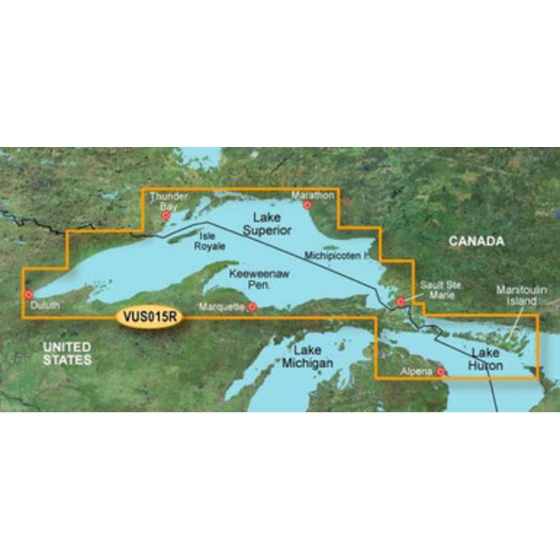
Garmin BlueChart g2 Vision Lake Superior SD Card: Chart VUS015R - Lake Superior covers Lake Superior and northern Lake Huron are covered in detail for the U.S. portion from Duluth through Alpena, including Crooked Lake, Burt Lake, and Mullett Lake in Michi
Garmin BlueChart g2 Vision Lake Superior SD Card: Chart VUS015R – Lake Superior covers Lake Superior and northern Lake Huron are covered in detail for the U.S. portion from Duluth through Alpena, including Crooked Lake, Burt Lake, and Mullett Lake in Michigan; and for the Canadian portion from Thunder Bay to Tobermory, Ont.
Garmin BlueChart g2 Vision has set the industry standard in premier electronic chartplotter-based marine charting. BlueChart g2 Vision offers the high detail charting of BlueChart g2 plus high-resolution satellite imagery, above and below water 3-D perspective, auto guidance technology, aerial photographs for real world reference, and coastal roads with points of interest.
Enable the full functionality of Garmin’s new line of chartplotters – the GPSMAP 5XXX series, the GPSMAP 4XXX series, the GPSMAP 5X5 series, the GPSMAP 5X0 series and the GPSMAP 4X0 – with the addition of a BlueChart g2 Vision SD card.
 sale
sale
 sale
sale
 sale
sale
Copyright © 2025 .All Rights Reserved.Powered by www.boatmaintenances.com

Reviews
There are no reviews yet.