FREE SHIPPING Over $30 -> Up to 50% Off!
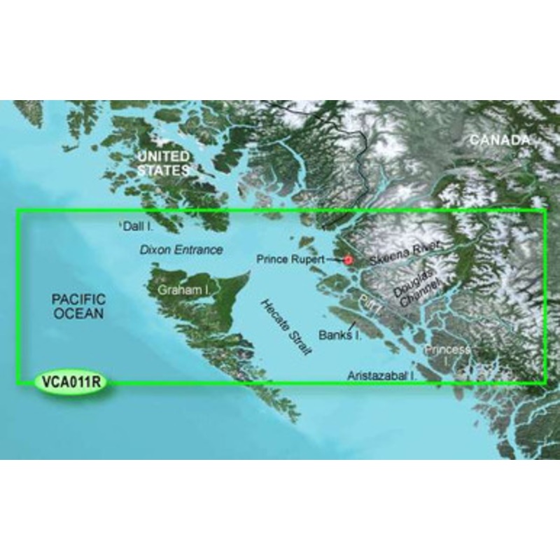
Garmin BlueChart g2 Vision Hecate Strait North SD Card: Chart VCA011R - Hecate Strait North includes coverage of the northern portion of the Queen Charlotte Islands, Hecate Strait and Dixon Entrance from Duke Island to the northern portion of Aristazabal I
Garmin BlueChart g2 Vision Hecate Strait North SD Card: Chart VCA011R – Hecate Strait North includes coverage of the northern portion of the Queen Charlotte Islands, Hecate Strait and Dixon Entrance from Duke Island to the northern portion of Aristazabal Island. Includes detailed coverage of many areas including Prince Rupert, BC, and the Grenville Channel.
Garmin BlueChart g2 Vision has set the industry standard in premier electronic chartplotter-based marine charting. BlueChart g2 Vision offers the high detail charting of BlueChart g2 plus high-resolution satellite imagery, above and below water 3-D perspective, auto guidance technology, aerial photographs for real world reference, and coastal roads with points of interest.
Enable the full functionality of Garmin’s new line of chartplotters – the GPSMAP 5XXX series, the GPSMAP 4XXX series, the GPSMAP 5X5 series, the GPSMAP 5X0 series and the GPSMAP 4X0 – with the addition of a BlueChart g2 Vision SD card.
 sale
sale
 sale
sale
 sale
sale
Copyright © 2025 .All Rights Reserved.Powered by www.boatmaintenances.com
Reviews
There are no reviews yet.