FREE SHIPPING Over $30 -> Up to 50% Off!
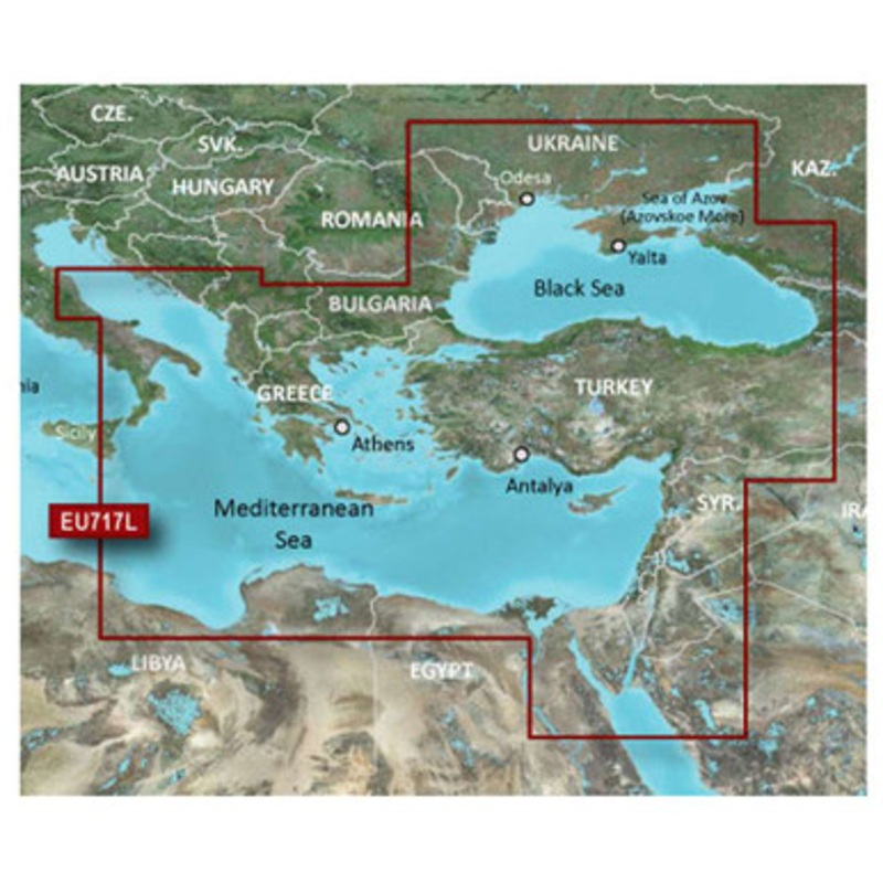
The Garmin 010-C1085-20 BlueChart g2 - HXEU717L provides detailed coverage of the Eastern Mediterranean Sea and Black Sea. Garmin BlueChart g2 Marine Maps allow you to see your vessel's precise, on-chart position in relation to navaids, coastal features, o
The Garmin 010-C1085-20 BlueChart g2 – HXEU717L provides detailed coverage of the Eastern Mediterranean Sea and Black Sea. Garmin BlueChart g2 Marine Maps allow you to see your vessel’s precise, on-chart position in relation to navaids, coastal features, obstructions, anchorages, waterways, restricted areas and more.
*Only available on compatible devices
Detailed coverage of the Eastern Mediterranean Sea and the Black Sea, including the Straights of Messina, the Adriatic Sea up to Pescara, IT, the Aegean Sea, the Suez Canal and Upper Red Sea, the Bosphorus Straight, the Dardanelles and the Sea of Azov. Ports included are Syracuse and Taranto, IT; Split, HR; Athens, GR; Istanbul, Antayla and Trabzon, TR; Odessa, UA; Sevastopol and Yalta, RU; and Alexandria, EG.
 sale
sale
 sale
sale
 sale
sale
Copyright © 2025 .All Rights Reserved.Powered by www.boatmaintenances.com
Reviews
There are no reviews yet.