FREE SHIPPING Over $30 -> Up to 50% Off!
CMAP MAX Electronic Charts:Bring your electronic charts to life with MAX, the ultimate navigator, and make cruising, sailing and fishing easier, safer and more fun. You'll benefit from the most accurate chart detail, versatile features and a wealth of impo
CMAP MAX Electronic Charts:
Bring your electronic charts to life with MAX, the ultimate navigator, and make cruising, sailing and fishing easier, safer and more fun. You’ll benefit from the most accurate chart detail, versatile features and a wealth of important data.
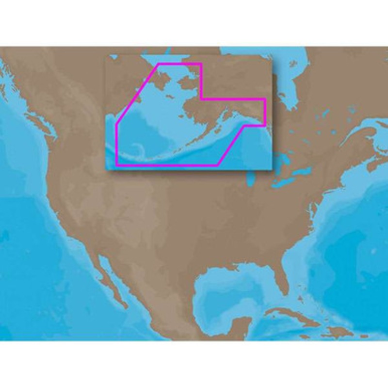
C-MAP MAX NA-M820 – Alaskan Coasts: Bathy – C-Card Coverage:
Coverage includes the offshore bathymetric details for the coast of Alaska from Dry Bay, just east of Yakutat Bay, to Attu Island at the end of the Aleutian Island chain, and then up to Cape Prince of Wales in the Bering Strait.
Includes all of Bristol Bay, Cook Inlet and Prince William Sound. Fishing Contour Charts do not include coastal navigational features and are recommended for offshore fishing only.
More Features and Specifications
 sale
sale
 sale
sale
 sale
sale
Copyright © 2025 .All Rights Reserved.Powered by www.boatmaintenances.com
Reviews
There are no reviews yet.