FREE SHIPPING Over $30 -> Up to 50% Off!
CMAP MAX Electronic Charts:Bring your electronic charts to life with MAX, the ultimate navigator, and make cruising, sailing and fishing easier, safer and more fun. You'll benefit from the most accurate chart detail, versatile features and a wealth of impo
CMAP MAX Electronic Charts:
Bring your electronic charts to life with MAX, the ultimate navigator, and make cruising, sailing and fishing easier, safer and more fun. You’ll benefit from the most accurate chart detail, versatile features and a wealth of important data.
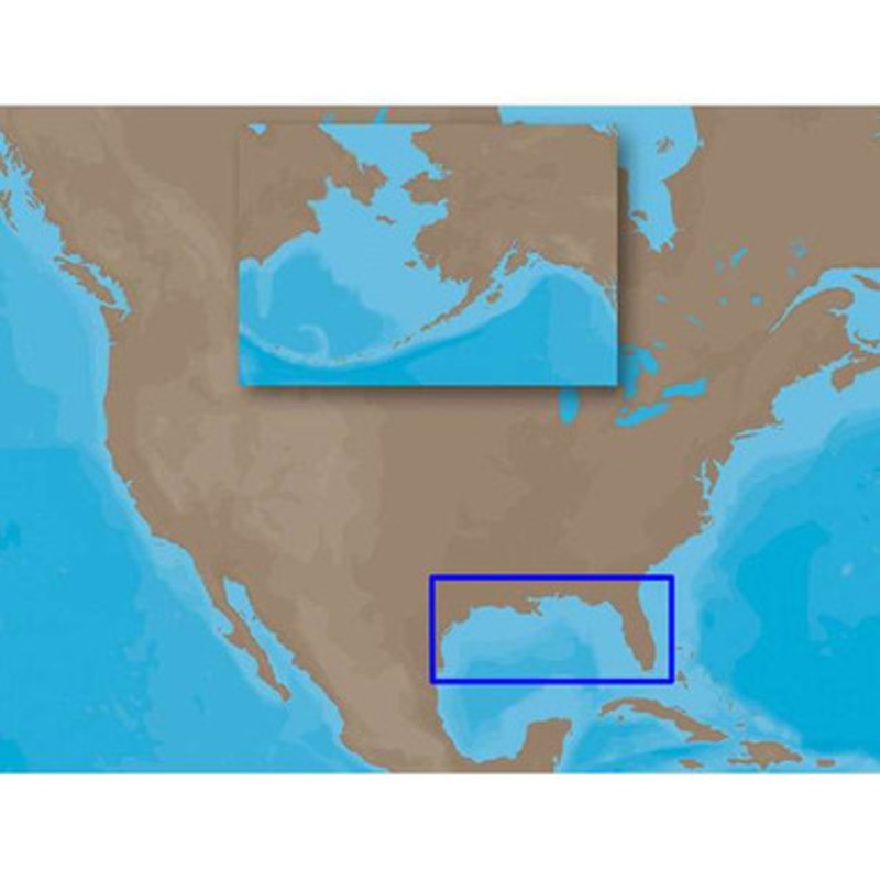
C-MAP MAX NA-M420 – Gulf of Mexico: Bathy – SD-Card Coverage:
Coverage includes the offshore bathymetric details for the Gulf of Mexico from Key West, FL over and around to Brownsville, TX.
Additional coverage up the eastern coast of Florida to Jacksonville is included.
Some coverage of the Bahamas is also included, covering western Northwest Providence Channel and the banks and shoals around Bimini.
Fishing Contour Charts do not include coastal navigational features and are recommended for offshore fishing only.
More Features and Specifications
 sale
sale
 sale
sale
Copyright © 2025 .All Rights Reserved.Powered by www.boatmaintenances.com
Reviews
There are no reviews yet.