FREE SHIPPING Over $30 -> Up to 50% Off!
Max-N Wide Cartography f/Lowrance, Simrad Yachting & B&G Chartplotters and Multifunction DisplaysMAX-N Wide provides additional C-MAP features such as harbor, detailed marina charts and coverage of inland rivers and lakes. When you choose C-MAP you get the
Max-N Wide Cartography f/Lowrance, Simrad Yachting & B&G Chartplotters and Multifunction Displays
MAX-N Wide provides additional C-MAP features such as harbor, detailed marina charts and coverage of inland rivers and lakes. When you choose C-MAP you get the best charts, using the most reliable sources around the globe, from a company committed to safe navigation.
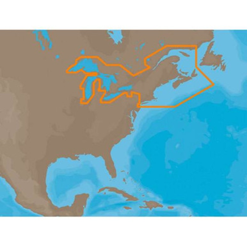
C-MAP MAX-N NA-N026 – Great Lakes, Northeast Coast & Approaches Coverage:
Coverage of the Great Lakes, St. Lawrence River and Northeast United States.
Coverage of the Great Lakes also includes Fox River and Lake Winnebago, Lake St. Clair, Rideau Canal, Ottawa River and the Trent-Severn Waterway.
Includes all coastal charts for New Brunswick and Nova Scotia in Canada and Maine, New Hampshire, Massachusetts, Connecticut and New York in the U.S.
Also included is coverage of the Hudson River and Lake Champlain as well as the Erie Barge Canal.
More Features and Specifications
Copyright © 2025 .All Rights Reserved.Powered by www.boatmaintenances.com
Reviews
There are no reviews yet.