FREE SHIPPING Over $30 -> Up to 50% Off!
Max-N Wide Cartography f/Lowrance, Simrad Yachting & B&G Chartplotters and Multifunction Displays MAX-N Wide provides additional C-MAP features such as harbor, detailed marina charts and coverage of inland rivers and lakes. When you choose C-MAP you get th
Max-N Wide Cartography f/Lowrance, Simrad Yachting & B&G Chartplotters and Multifunction Displays
MAX-N Wide provides additional C-MAP features such as harbor, detailed marina charts and coverage of inland rivers and lakes. When you choose C-MAP you get the best charts, using the most reliable sources around the globe, from a company committed to safe navigation.
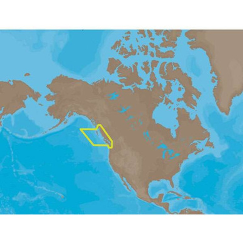
C-MAP MAX-N NA-N025 – Canada West Including Puget Sound Coverage:
Coverage of British Columbia, Puget Sound and the San Juan Islands.
Full coverage of Vancouver Island and the Queen Charlotte Islands is also included.
Full coverage of Puget Sound and the Strait of Juan De Fuca are also present.
Extended coverage of the Vancouver Harbor area includes Pitt Lake, Indian Arm and Harrison Lake.
More Features and Specifications
Copyright © 2025 .All Rights Reserved.Powered by www.boatmaintenances.com

Reviews
There are no reviews yet.