FREE SHIPPING Over $30 -> Up to 50% Off!
C-MAP 4D Electronic Marine Charts are the next evolution in navigation solutions. C-MAP 4D adapts to your boating needs because it's the only digital chart that offers advanced features and lets you add data and services as they become available.C-MAP 4D c
C-MAP 4D Electronic Marine Charts are the next evolution in navigation solutions. C-MAP 4D adapts to your boating needs because it’s the only digital chart that offers advanced features and lets you add data and services as they become available.
C-MAP 4D cartography is compatible with the Furuno 1670F / 1870F, and Standard CPN 7000i, and CPN1010i units.
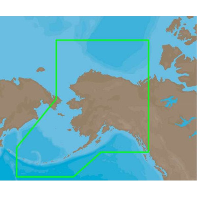
C-MAP 4D NA-D024 – USA West Coast & Hawaii – Full Content Coverage:
Coverage of the southern Alaska coast from Dixon Entrance up and over to Kodiak Island.
Includes all of the Aleutian Islands out to Attu Island, Bristol Bay, and the North Slope over to Liverpool Bay in the Yukon Territory, Canada.
Additional coverage of the MacKenzie River down to the 1160 km distance marker.
More Features and Specifications
 sale
sale
 sale
sale
Copyright © 2025 .All Rights Reserved.Powered by www.boatmaintenances.com
Reviews
There are no reviews yet.