FREE SHIPPING Over $30 -> Up to 50% Off!
C-MAP 4D Electronic Marine Charts are the next evolution in navigation solutions. C-MAP 4D adapts to your boating needs because it's the only digital chart that offers advanced features and lets you add data and services as they become available.C-MAP 4D c
C-MAP 4D Electronic Marine Charts are the next evolution in navigation solutions. C-MAP 4D adapts to your boating needs because it’s the only digital chart that offers advanced features and lets you add data and services as they become available.
C-MAP 4D cartography is compatible with the Furuno 1670F / 1870F, and Standard CPN 7000i, and CPN1010i units.
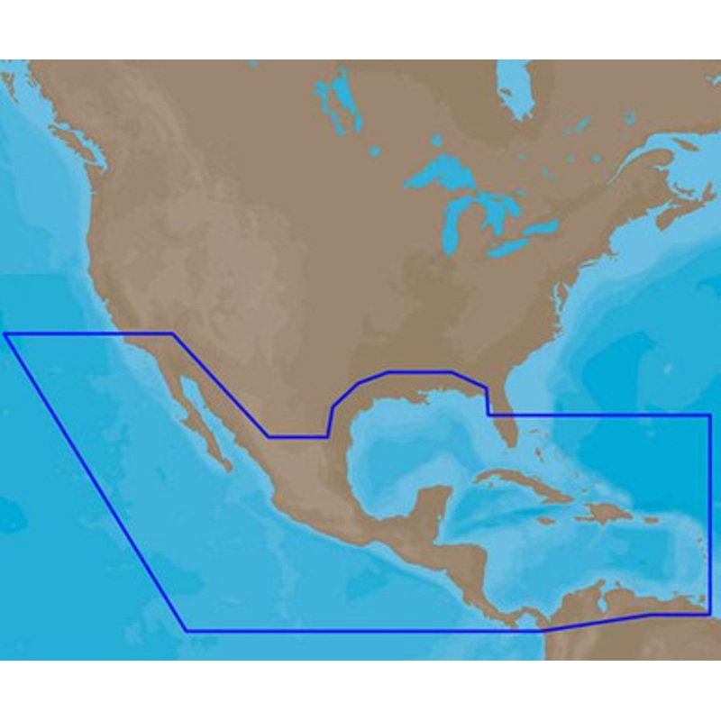
C-MAP 4D NA-D027 – Central America & Caribbean – Full Content Coverage:
Coverage of Central America, all of the Caribbean and the northern coast of South America, and the Gulf of Mexico.
Coverage of the Pacific coast starts at Point Conception, CA and runs down to Bahia Cupica, Colombia.
Coverage of the United States starts in Cumberland Sound, GA and runs down around Florida and over to Brownsville, TX. Bahamas, Turks and Caicos and all islands of the Caribbean are included.
South American coverage includes the northern coasts of Colombia and Venezuela over to Rio Orinoco, including Trinidad and Tobago.
Caribbean coverage includes charts from Explorer Chartbooks and Wavey Line Publishing.
More Features and Specifications
 sale
sale
 sale
sale
 sale
sale
 sale
sale
Copyright © 2025 .All Rights Reserved.Powered by www.boatmaintenances.com
Reviews
There are no reviews yet.