FREE SHIPPING Over $30 -> Up to 50% Off!
C-MAP 4D Electronic Marine Charts are the next evolution in navigation solutions. C-MAP 4D adapts to your boating needs because it's the only digital chart that offers advanced features and lets you add data and services as they become available.C-MAP 4D c
C-MAP 4D Electronic Marine Charts are the next evolution in navigation solutions. C-MAP 4D adapts to your boating needs because it’s the only digital chart that offers advanced features and lets you add data and services as they become available.
C-MAP 4D cartography is compatible with the Furuno 1670F / 1870F, and Standard CPN 7000i, and CPN1010i units.
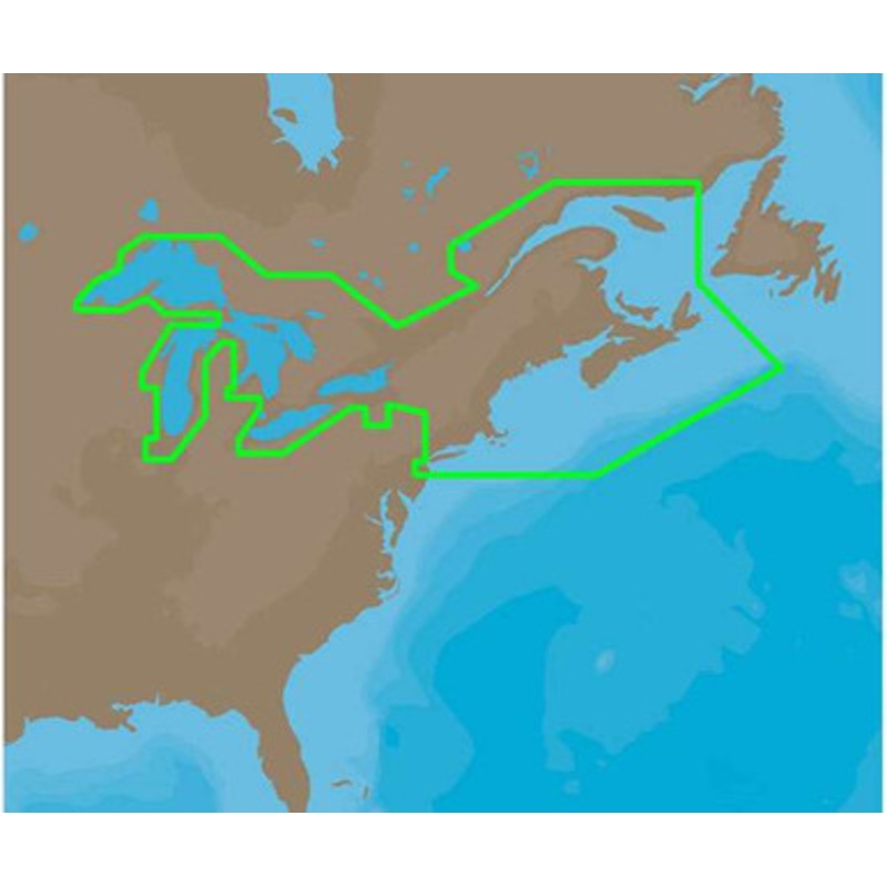
C-MAP 4D NA-D026 – Great Lakes, Northeast Coast & The Maritimes Coverage:
Coverage of the Great Lakes, St. Lawrence River and Northeast United States.
Coverage of the Great Lakes also includes Fox River and Lake Winnebago, Lake St. Clair,Rideau Canal, Ottawa River and the Trent-Severn Waterway.
Includes all coastal charts for New Brunswick and Nova Scotia in Canada and Maine, New Hampshire, Massachusetts, Connecticut and New York in the U.S.
Also included is coverage of the Hudson River and LakeChamplain as well as the Erie Barge Canal.
More Features and Specifications
 sale
sale
 sale
sale
 sale
sale
Copyright © 2025 .All Rights Reserved.Powered by www.boatmaintenances.com
Reviews
There are no reviews yet.