FREE SHIPPING Over $30 -> Up to 50% Off!
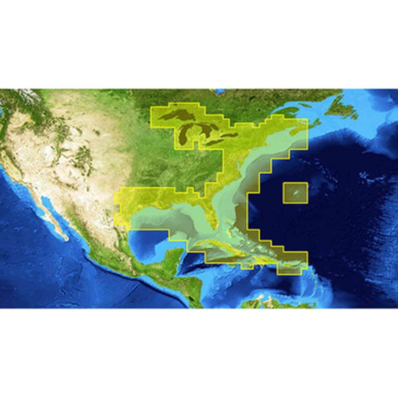
Lowrance 000-12218-001 Nautic Insight HD East v15 Marine Charts offer advanced detail Eastern U.S. coastal and offshore sea maps for fishing, cruising, and sailing, with high-definition shaded relief that provides enhanced views of underwater structures.Lo
Lowrance 000-12218-001 Nautic Insight HD East v15 Marine Charts offer advanced detail Eastern U.S. coastal and offshore sea maps for fishing, cruising, and sailing, with high-definition shaded relief that provides enhanced views of underwater structures.
Lowrance 000-12218-001 Nautic Insight HD East v15 Key Features:
 sale
sale
 sale
sale
Copyright © 2025 .All Rights Reserved.Powered by www.boatmaintenances.com
Reviews
There are no reviews yet.