FREE SHIPPING Over $30 -> Up to 50% Off!
Designed for freshwater fishing and hunting, MAX Lakes delivers the highest level of detail and value-added data not found on any other electronic charts on the market. Also, the MAX Lakes database is constantly growing and is updated yearly! C-MAP MAX Lak
Designed for freshwater fishing and hunting, MAX Lakes delivers the highest level of detail and value-added data not found on any other electronic charts on the market. Also, the MAX Lakes database is constantly growing and is updated yearly!
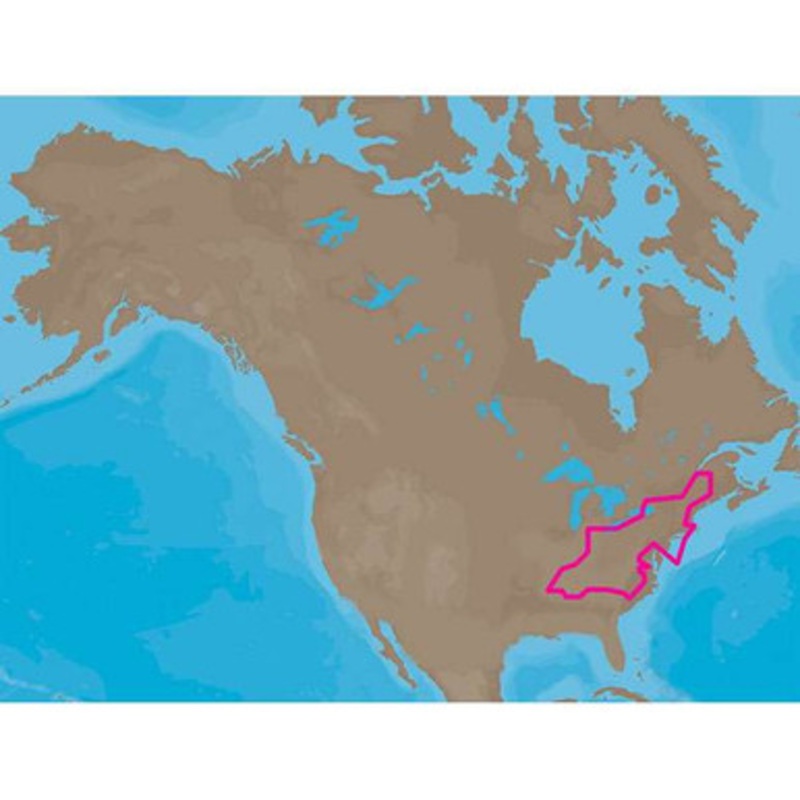
C-MAP MAX Lakes NA-M018 – Region 2: East – C-Card Coverage:
Includes coverage for 900+ lakes in Maine, New Hampshire, Vermont, Massachusetts, Rhode Island, New York, Connecticut, Pennsylvania, Maryland, New Jersey, Delaware, Ohio, Virginia, West Virginia, Kentucky, Tennessee and North Carolina.
River coverage includes the Hudson River and Erie Barge Canal (to Lyons, NY) as well as all of the Ohio River from Cairo, IL (MM 981) to Pittsburgh, PA (MM 0), the Tennessee River from Paducah, KY (MM 0) to Knoxville, TN (MM 652), the Cumberland River from Smithland, KY (MM 0) to the Kentucky/Tennessee border (MM 389), as well as the Green River in Kentucky, the Kanawha River in West Virginia and the Allegheny and Monongahela Rivers in Pennsylvania.
Partial coverage of the Lower Mississippi River from Memphis, TN (MM 711) to Cairo, IL (MM 953) is also included.
More Features and Specifications
 sale
sale
 sale
sale
 sale
sale
Copyright © 2025 .All Rights Reserved.Powered by www.boatmaintenances.com
Reviews
There are no reviews yet.