FREE SHIPPING Over $30 -> Up to 50% Off!
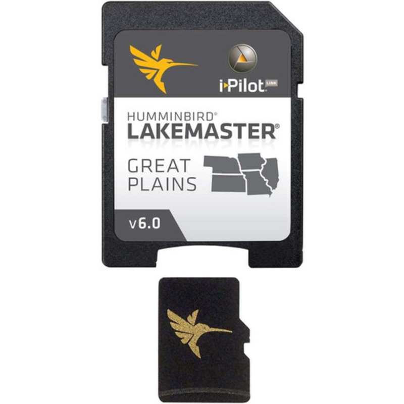
The Humminbird 600017-5 Lakemaster Chart - Great Plains - MicroSD/SD is a part of Humminbird's series of LakeMaster Charts that give you a serious edge with their unmatched accuracy and detail. Patented features include the ability to select and highlight
The Humminbird 600017-5 Lakemaster Chart – Great Plains – MicroSD/SD is a part of Humminbird’s series of LakeMaster Charts that give you a serious edge with their unmatched accuracy and detail. Patented features include the ability to select and highlight a specific depth range, the option to shade shallow water ranging from 0 to 30 ft, and the power to synchronize depth chart contours and shorelines with the current water levels of rivers, lakes, and reservoirs. These exclusive features (and more,) will provide you with everything you need to make your time on the water more productive.
Combines many of the best fishing waters for Nebraska, Missouri, Kansas, Illinois, and Iowa all on one map card. Follow the Contour technology allows anglers with i-Pilot Link to follow the shoreline at a specified offset so you can focus on fishing.
Contains 160 new or updated lakes from the previous version, and now has over 500 total lakes with contours, of which more than 400 are now high-definition lakes including:
The map card also features other great fishing waters, including:
Additionally, the card has outstanding coverage on Lake Michigan:
 sale
sale
 sale
sale
 sale
sale
 sale
sale
Copyright © 2025 .All Rights Reserved.Powered by www.boatmaintenances.com
Reviews
There are no reviews yet.