FREE SHIPPING Over $30 -> Up to 50% Off!
C-MAP 4D Electronic Marine Charts are the next evolution in navigation solutions. C-MAP 4D adapts to your boating needs because it's the only digital chart that offers advanced features and lets you add data and services as they become available.C-MAP 4D c
C-MAP 4D Electronic Marine Charts are the next evolution in navigation solutions. C-MAP 4D adapts to your boating needs because it’s the only digital chart that offers advanced features and lets you add data and services as they become available.
C-MAP 4D cartography is compatible with the Furuno 1670F / 1870F, and Standard CPN 7000i, and CPN1010i units.
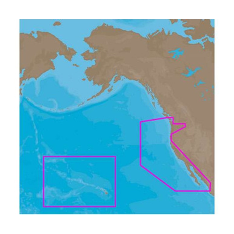
C-MAP 4D NA-D024 – USA West Coast & Hawaii – Full Content Coverage:
Coverage of the Pacific Coast of the United States, including all of the coasts of California, Oregon and Washington.
Coverage of Baja California and Mexico down to Puerto Vallarta.
Detail of the Columbia River, Sacramento River, Willamette River.
Snake River and San Joaquin Rivers are also included.
Full coverage of Puget Sound and the San Juan Islands up to Point Roberts is also included.
Additional coverage of the Hawaiian Islands out to Midway and Johnston Atoll is also included.
More Features and Specifications
 sale
sale
 sale
sale
 sale
sale
Copyright © 2025 .All Rights Reserved.Powered by www.boatmaintenances.com
Reviews
There are no reviews yet.