FREE SHIPPING Over $30 -> Up to 50% Off!
CMAP MAX Electronic Charts:Bring your electronic charts to life with MAX, the ultimate navigator, and make cruising, sailing and fishing easier, safer and more fun. You'll benefit from the most accurate chart detail, versatile features and a wealth of impo
CMAP MAX Electronic Charts:
Bring your electronic charts to life with MAX, the ultimate navigator, and make cruising, sailing and fishing easier, safer and more fun. You’ll benefit from the most accurate chart detail, versatile features and a wealth of important data.
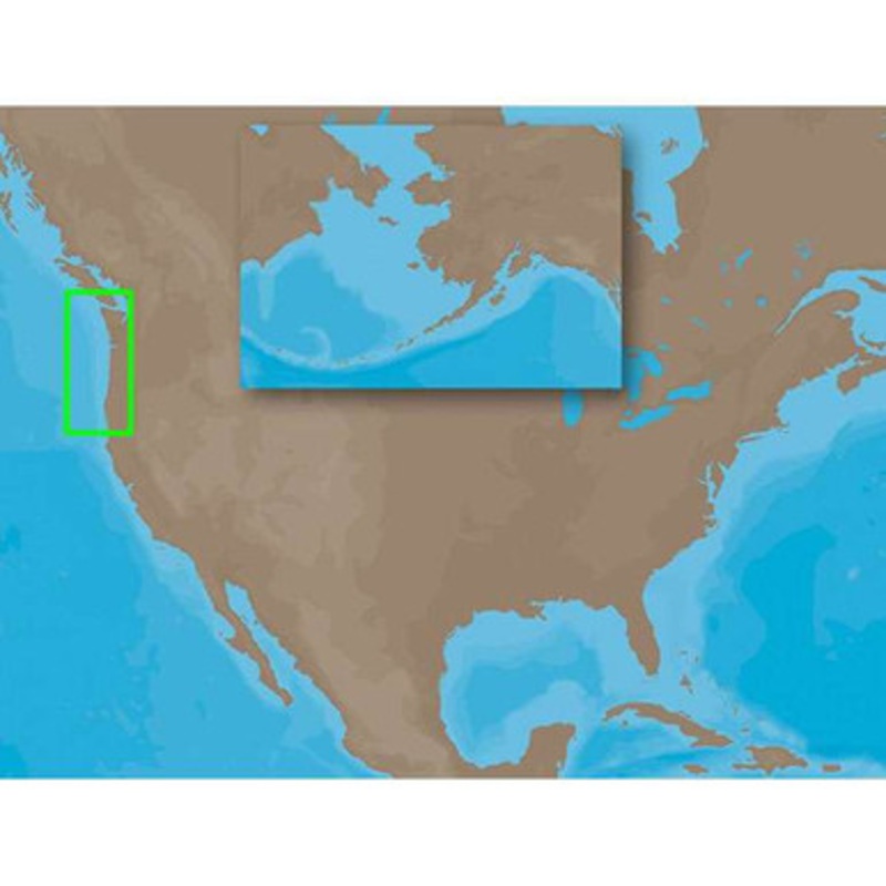
C-MAP MAX NA-M621 – Cape Blanco, OR-Puget Sound – SD-Card Coverage:
Coverage includes the offshore bathymetric details for the coasts of Oregon and Washington.
Coverage actually starts around the Klamath River delta in California and goes up to Cape Flattery, and around into Puget Sound.
Coverage of the San Juan Islands up to Point Roberts is also included.
Fishing Contour Charts do not include coastal navigational features and are recommended for offshore fishing only.
More Features and Specifications
 sale
sale
 sale
sale
 sale
sale
Copyright © 2025 .All Rights Reserved.Powered by www.boatmaintenances.com
Reviews
There are no reviews yet.