FREE SHIPPING Over $30 -> Up to 50% Off!
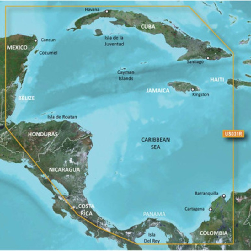
The Garmin 010-C0732-20 Bluechart G2 Southwest Caribbean microSD/SD Card provides detailed coverage of the northern coast of Central America all the way from Cancun, Mexico to Barranquilla, Colombia, and including the Panama Canal in its entirety. Also inc
The Garmin 010-C0732-20 Bluechart G2 Southwest Caribbean microSD/SD Card provides detailed coverage of the northern coast of Central America all the way from Cancun, Mexico to Barranquilla, Colombia, and including the Panama Canal in its entirety. Also includes General coverage of the northern half of the Gulf of Panama and detailed coverage of the coasts of Jamaica, Cuba, and the entirety of the Caymans.
See your vessel’s precise position on-chart in relation to navaids, coastal features, spot soundings, port plans, waterways, anchorages, obstructions, restricted areas and more. BlueChart g2 HD provides seamless chart presentation with 1-foot HD contours to provide a more accurate depiction of bottom structure for improved fishing charts and navigation in swamps, marinas, canals, and port plans. Coverage is available worldwide in regional offerings for Garmin handhelds and chartplotters.
Improve your view with 1-foot HD contours
 sale
sale
 sale
sale
 sale
sale
Copyright © 2025 .All Rights Reserved.Powered by www.boatmaintenances.com
Reviews
There are no reviews yet.