FREE SHIPPING Over $30 -> Up to 50% Off!
CMAP MAX Electronic Charts:Bring your electronic charts to life with MAX, the ultimate navigator, and make cruising, sailing and fishing easier, safer and more fun. You'll benefit from the most accurate chart detail, versatile features and a wealth of impo
CMAP MAX Electronic Charts:
Bring your electronic charts to life with MAX, the ultimate navigator, and make cruising, sailing and fishing easier, safer and more fun. You’ll benefit from the most accurate chart detail, versatile features and a wealth of important data.
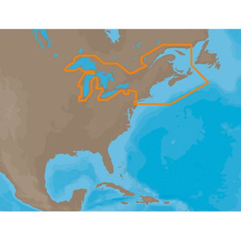
C-MAP MAX NA-M026 – Great Lakes & The Maritimes – C-Card Coverage:
Coverage of the Great Lakes, St. Lawrence River and Northeast United States.
Coverage of the Great Lakes also includes Fox River and Lake Winnebago, Lake St. Clair, Rideau Canal, Ottawa River and the Trent-Severn Waterway.
Includes all coastal charts for New Brunswick and Nova Scotia in Canada and Maine, New Hampshire, Massachusetts, Connecticut and New York in the U.S.
Also included is coverage of the Hudson River and Lake Champlain as well as the Erie Barge Canal.
More Features and Specifications
 sale
sale
 sale
sale
Copyright © 2025 .All Rights Reserved.Powered by www.boatmaintenances.com
Reviews
There are no reviews yet.