FREE SHIPPING Over $30 -> Up to 50% Off!
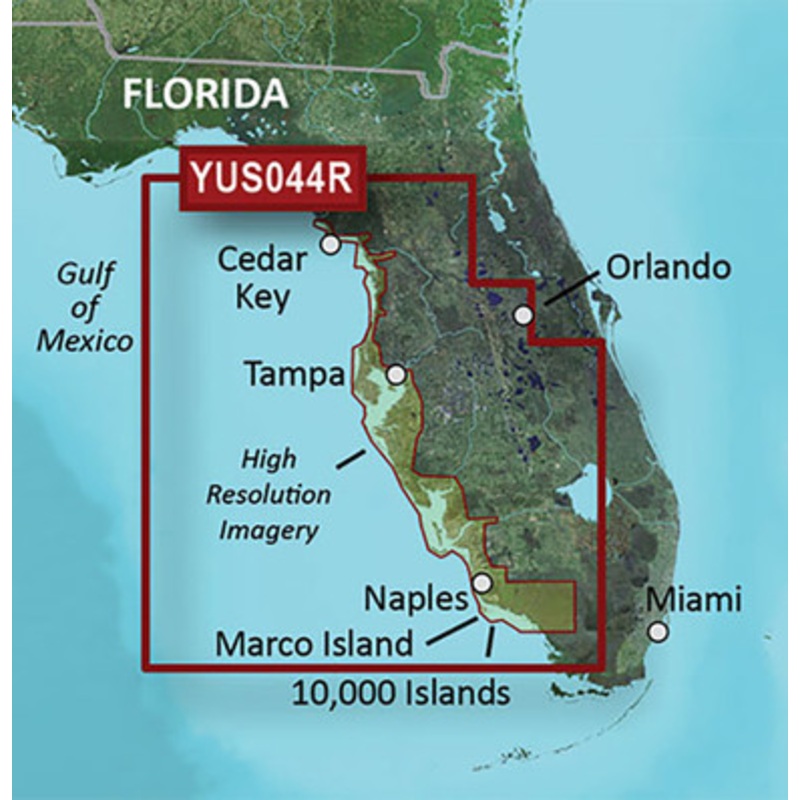
BlueChart g2 HD w/High Resolution Satellite Imagery - Florida Gulf CoastCombining on-screen navigation with the latest in high-resolution satellite imagery, this mapping product - with complete coverage on a single card - offers clear and current informati
BlueChart g2 HD w/High Resolution Satellite Imagery – Florida Gulf Coast
Combining on-screen navigation with the latest in high-resolution satellite imagery, this mapping product – with complete coverage on a single card – offers clear and current information regarding access to those backwaters, swamps and canals where standard government-issued marine charts may not accurately represent the shifting shorelines of navigable waterways.
Features:
Coverage:
Features coverage of the Florida Gulf Coast, from Cedar Key to Naples, including Tampa Bay, Ten Thousand Islands, and Marco Island in g2 HD detail with up to 1-foot HD fishing contours and 1-meter high resolution satellite imagery. Lake Okeechobee and the Okeechobee Waterway also are included in g2 HD detail.
 sale
sale
 sale
sale
 sale
sale
 sale
sale
Copyright © 2025 .All Rights Reserved.Powered by www.boatmaintenances.com
Reviews
There are no reviews yet.