FREE SHIPPING Over $30 -> Up to 50% Off!
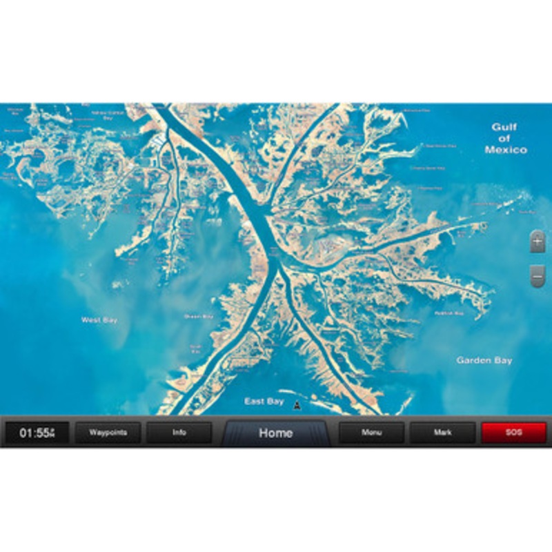
Standard Mapping - Louisiana One ClassicmicroSD/SD card Statewide coastal aerial overlay provides high-resolution imagery and local names of waterways and land features.High-resolution Aerial ImageryReplaces the basemap so you can see every waterway and la
Standard Mapping – Louisiana One ClassicmicroSD/SD card
Statewide coastal aerial overlay provides high-resolution imagery and local names of waterways and land features.
High-resolution Aerial Imagery
Replaces the basemap so you can see every waterway and land feature.
High-definition Offshore Mapping
High-contrast offshore elevation shading allows you to easily see detail.
Local Names
Identifies local waterways and land features.
 sale
sale
 sale
sale
Copyright © 2025 .All Rights Reserved.Powered by www.boatmaintenances.com
Reviews
There are no reviews yet.